Geographic Location Σ
Unique allocation. Note: Summary without bases inside the USA
-
-
PL | Zagan Training Area
 https://www.openstreetbrowser.org/#map=11/51.4741/15.3970&categories=military
51.54, 15.35
https://www.openstreetbrowser.org/#map=11/51.4741/15.3970&categories=military
51.54, 15.35 Wikipedia: n/a
 -
DJI | Base Aerienne de Chabelley
https://www.openstreetbrowser.org/#map=15/11.5189/43.0634&categories=military
11.517971, 43.068208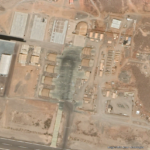
Google Earth 2021 Wikipedia EN: https://en.wikipedia.org/wiki/Chabelley_Airport
FR: https://fr.wikipedia.org/wiki/Base_a%C3%A9rienne_de_Chabelley -
ROU | Mihail Kogălniceanu, Constanţa
https://www.openstreetbrowser.org/#map=15/44.3614/28.4744&categories=military
44.36, 28.47
Wikipedia EN: https://en.wikipedia.org/wiki/RoAF_57th_Air_Base
also: https://en.wikipedia.org/wiki/Mihail_Kog%C4%83lniceanu_International_Airport
DE: https://de.wikipedia.org/wiki/Flughafen_Constan%C8%9BaBlack Site DE: https://de.wikipedia.org/wiki/Black_Site
In 2024, construction began on a project aimed at modernizing and expanding the base. Under the same project, it is planned to build a military city similar to Ramstein Air Base, where more than 10,000 NATO servicemen will live together with their families. (Wikipedia)
-
USA | Guam (Σ)
https://www.openstreetbrowser.org/#map=11/13.4424/144.7826&categories=military
13.42, 144.66
click for full size Wikipedia EN: https://en.wikipedia.org/wiki/Guam
-
MH | Ballistic Missile Defense Test Site
https://www.openstreetbrowser.org/#map=15/8.7286/167.7318&categories=military
Wikipedia EN: https://en.wikipedia.org/wiki/Marshall_Islands
Ennylabegan Island Army Active Kwajalein Atoll – Illeginni Island Army Active Kwajalein Atoll – Legan Island Army Active Kwajalein Atoll – Meck Island Army Active Kwajalein Atoll – Omelek Island Army Active Kwajalein Atoll – Roi-Namur Island Army Active Kwajalein Atoll – US Army Kwajalein Atoll Army Active Kwajalein Atoll – Other smll base sites connected to Kwajalein R.Reagan Test Site
More Info: https://www.bikiniatoll.com/
-
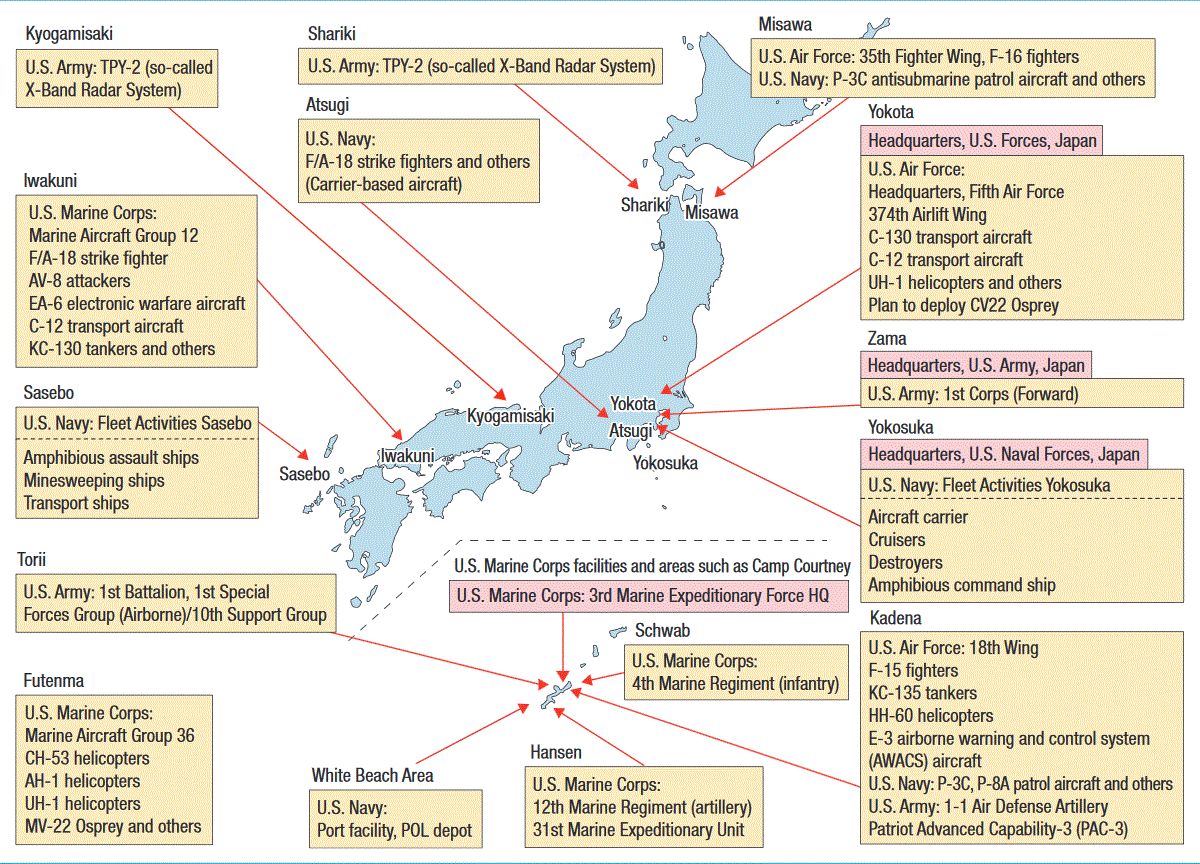
JPN | Okinawa (Σ)
https://www.openstreetbrowser.org/#map=11/26.4048/127.9118&categories=military

click for full size Wikipedia EN: https://en.wikipedia.org/wiki/Okinawa_Prefecture
https://en.wikipedia.org/wiki/Marine_Corps_Base_Camp_Smedley_D._ButlerDE: https://de.wikipedia.org/wiki/Okinawa_Hont%C5%8D
Source: Wikimedia -
AUS | Darwin RAAF Base
https://www.openstreetbrowser.org/#map=12/-12.4108/130.9538&categories=military
-12.414177, 130.898907
Robertson Barracks
-
AUS | East Chapman Australian Defence Satellite Comm. Station
https://www.openstreetbrowser.org/#map=15/-28.6977/114.8431&categories=military

-28.700000, 114.840000
Wikipedia EN: n/a
MUOS, Echelon
Note:
Local resistance -
-
AUS | Learmonth RAAF Base
https://www.openstreetbrowser.org/#map=14/-22.2402/114.1125&categories=military
-22.24, 114.10
Wikipedia EN: RAAF Base Learmonth
-
-
AFG | Bagram Air Base
https://www.openstreetbrowser.org/#map=13/34.9392/69.2710&categories=military
34.947581,  69.265913

Google Earth 2021 (2009) Wikipedia EN: https://en.wikipedia.org/wiki/Bagram_Airfield
DE: https://de.wikipedia.org/wiki/Bagram_Air_Base
-
AFG | Kabul ISAF
https://www.openstreetbrowser.org/#map=15/34.5322/69.1954&categories=military
34.53147, 69.19004
Wikipedia EN:
-
TR | Incirlik Air Base
https://www.openstreetbrowser.org/#map=14/37.0057/35.4246&categories=military
37.00, 35.42
Wikipedia EN: https://en.wikipedia.org/wiki/Incirlik_Air_Base
DE: https://de.wikipedia.org/wiki/Incirlik_Air_BaseOfficial Source: https://www.incirlik.af.mil/
Wikipedia EN: https://en.wikipedia.org/wiki/Nuclear_sharing
DE: https://de.wikipedia.org/wiki/Nukleare_Teilhabe -
. Shared Base | .. Depot | Europe | Germany
DEU | Bitburg: NATO-Pipeline Fuel Depot
https://www.openstreetbrowser.org/#map=15/49.9185/6.4802&categories=military
49.92, 6.48
Wikipedia DE: https://de.wikipedia.org/wiki/Tanklagerexplosion_bei_Niederstedem
Source: Landesbetrieb LBB RLP Projektdoku Pipelinesystem

-
-
-
-
JPN | Okinawa, Henoko: Camp Schwab
https://www.openstreetbrowser.org/#map=15/26.5318/128.0447&categories=military
26.52, 128.04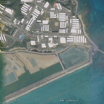
Google Earth 2020 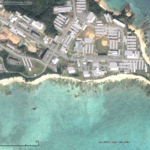
Google Earth 2014 Wikipedia EN: https://en.wikipedia.org/wiki/Camp_Schwab
see also: https://en.wikipedia.org/wiki/Relocation_of_Marine_Corps_Air_Station_Futenma
Campaign Info: https://www.peaceforokinawa.org/

.