
Pictures and Copyright
Copyright when using Google Earth Images
Excerpts:
You may annotate our maps with additional information – like points, lines, or labels.[…] If neither of those fit your needs, you may export an image from Google Earth or Earth Studio, or capture a screenshot from Google Maps, to add custom labels or graphics using third-party software.
While we encourage annotations, you must not significantly alter how Google Maps, Google Earth, Earth Studio, or Street View would look online. For example, you’re not allowed to make any changes to the colors of the product interface or remove attribution. […]
While we encourage annotations, you must not significantly alter how Google Maps, Google Earth, Earth Studio, or Street View would look online. For example, you’re not allowed to make any changes to the colors of the product interface or remove attribution. […]
Google Earth or Earth Studio can be used for purposes such as research, education, film and nonprofit use without needing permission.
All content created from Google Earth or Earth Studio must always be properly attributed.
Google Earth content may not be used for any commercial or promotional purposes.
Source and all information in detail: https://about.google/brand-resource-center/products-and-services/geo-guidelines/
Copyright when using OpenStreetmaps
Excerpts:
We require that you use the credit “© OpenStreetMap contributors”.
You must also make it clear that the data is available under the Open Database License. You may do this by linking to this copyright page. Alternatively, and as a requirement if you are distributing OSM in a data form, you can name and link directly to the license(s). In media where links are not possible (e.g. printed works), we suggest you direct your readers to openstreetmap.org (perhaps by expanding ‚OpenStreetMap‘ to this full address) and to opendatacommons.org. …
For a browsable electronic map, the credit should appear in the corner of the map. For example:
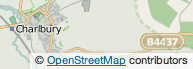 Source and all information in detail: https://www.openstreetmap.org/copyright